Just a few miles up-river from Aberfeldy, the shores of Loch Tay offer a variety of water activities and riding options.
- Road (Route 7)Distance12.13kmAscent50mDescent37m
- Gravel Route 1Distance12.23kmAscent342mDescent337m
- Gravel Route 2Distance14.17kmAscent387mDescent377m
- MTB Route 1Distance27.60kmAscent554mDescent540m
Road (Route 7)
The easiest, and shortest, route between Aberfeldy and Kenmore - the road route follows Cycle Route 7 along the B846. From Aberfeldy you'll head over Wades Bridge, through Weem, and up the valley towards Drummond Hill in the distance.
The road sign for Dull is a popular photo-op - the town is twinned with Boring, Oregon and Bland, France - to form the League of Extraordinary Communities. Just be careful while taking a photo as drivers are also distracted.
From Dull you'll soon reach the biggest hill of the route (only a few dozen meters in total), then head down to the Tay River where you'll make a hard-left across a bridge. Stay left after crossing the bridge to follow the road past the Mains of Taymouth Stables until you arrive at the north end of Kenmore.
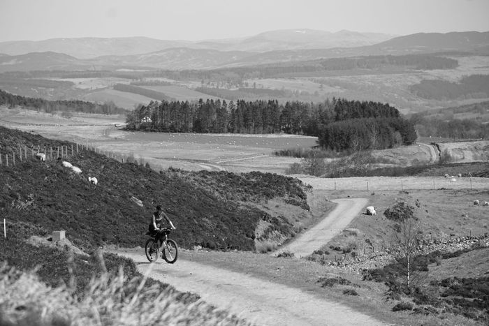
Gravel Route 1
While this is the easiest off-road route between Aberfeldy and Kenmore, it's not to be underestimated. Regardless of which end you start, you'll be going up right away, climbing at least 200 meters. Thankfully the majority of both of these climbs is on tarmac.
From Aberfeldy, head up Urlar Road and take a right just before the private drive starts. From here the road flattens a bit onto smooth gravel and you'll continue for 1 mile before a series of switchbacks, turning into a grassy track a short while later.
Continue up the grassy tracks, across a small burn, up again, until you top out at a gravel logging road. From here you'll get a short downhill and some amazing views, giving just enough time to rest before the climbing starts again.
The trail is easy to follow, but there are a few gates which will require dismounting to pass through. At the Kenmore end you'll pop out onto a road, with a steep, switchback decent into Kenmore.
Gravel Route 2
Similar to Gravel Route 1 between Aberfeldy and Kenmore, Gravel Route 2 takes it up a notch in both climbing, and scenery. No matter which direction you head, you'll start with a lung-busting climb from either Aberfeldy or Kenmore, before being rewarded with outstanding views along most of the route.
From Aberfeldy head up the steep Urlar Road south of town. Near the end of the paved track you'll see a sign indicating the "Walker's Route" goes left along the fence-line. If you're on a bike this track is difficult, so many continue on the paved road and through the farm - please go slow, be courteous, and watch for vehicles.
Once through the farm you'll hit the gravel, paralleling Moness Burn for several miles, past a private bothy (sometimes unlocked), and eventually out onto the Glen Quaich road. The gravel varies from smooth to rough, with several short hills, but nothing too technical.
When you hit the road, the hard work is done and you can enjoy a blistering decent into Kenmore. Check those brakes though, it's long and steep, with several hairpin turns.
MTB Route 1
If you're looking to make your journey to Kenmore a bit more adventurous, look no further than the MTB Route. It's got climbs, descents, gravel and single-track (and a bit of road). The route is better going from Aberfeldy to Kenmore due to several of the climbs, but could be done in reverse too.
From Aberfeldy head up Glassie Road toward the Bunkhouse and continue around the back and further into the uplands. You'll eventually turn off the gravel road (it can be easy to miss the turn), and onto some single-track up and over the hill to a private bothy (it's ok to stop in for a break, but it should not be used for lodging). Then weave your away down some dirt tracks before turning back uphill, gradually turning west to follow the Camserney Burn toward the B846.
Once on the road head south to join up Route 7 to head into Kenmore.